Bendy map of Manhattan
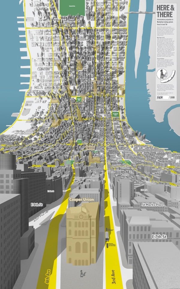
This is a little bit brilliant. Here and There are a pair of maps of Manhattan that start from an on-the-street viewpoint and curl up as you gaze uptown or downtown until you see the rest of the island from a traditional “flat map” view.
As the model bends from sideways to top-down in a smooth join, more distant parts of the city are revealed in plan view. The projection connects the viewer’s local environment to remote destinations normally out of sight.
Prints are available. This is like a 3-D version of the spider maps for London buses, in which a local street grid relays information about the immediate vicinity while the surrounding schematic shows connections to the rest of the system.
Update: Jack Schulze explains the influences behind the maps. (via waxy)
Update: Ooh, these science illustrations from NISE use a similar technique to simultaneously show the internal and external structure of their subjects.
These illustrations show familiar objects across ten orders of magnitude-from familiar aspects down to the level of their constituent atoms. Vast scale differences are usually shown through separate images (e.g., the Eames’ Powers of Ten). This illustration employs the artistic convention of perspective-typically used by landscape painters-to show multiple scales in one frame.
(thx, matt)
Stay Connected